
Date
30/07/2026
Location
Salone della Valle, piazza Vittorio Veneto, Gandino (BG)
Tracing the Calcato de’ Beni tutti della Spett.le Comunità di Gandino, 1747
A public seminar and a participatory research project
Organizers:
- Isabella Balestreri
- Francesca Biolo
- Franco Guzzetti
Department of Architecture, Built Environment and Construction Engineering (DABC), Politecnico di Milano
The initiative
This initiative is part of a non-financial agreement signed with the Municipality of Gandino within the framework of the PRIN2022PNRR project Built in Stone / Preserved on Paper. The Architectural Heritage of Italian Municipalities (12th–20th Century). Historical Research and Digitalization.
A second agreement, requested by the Municipality itself, is currently being developed to support additional research and dissemination activities within the project "Gandino nobile da vivere 2026", funded by the Lombardy Region.
The seminar
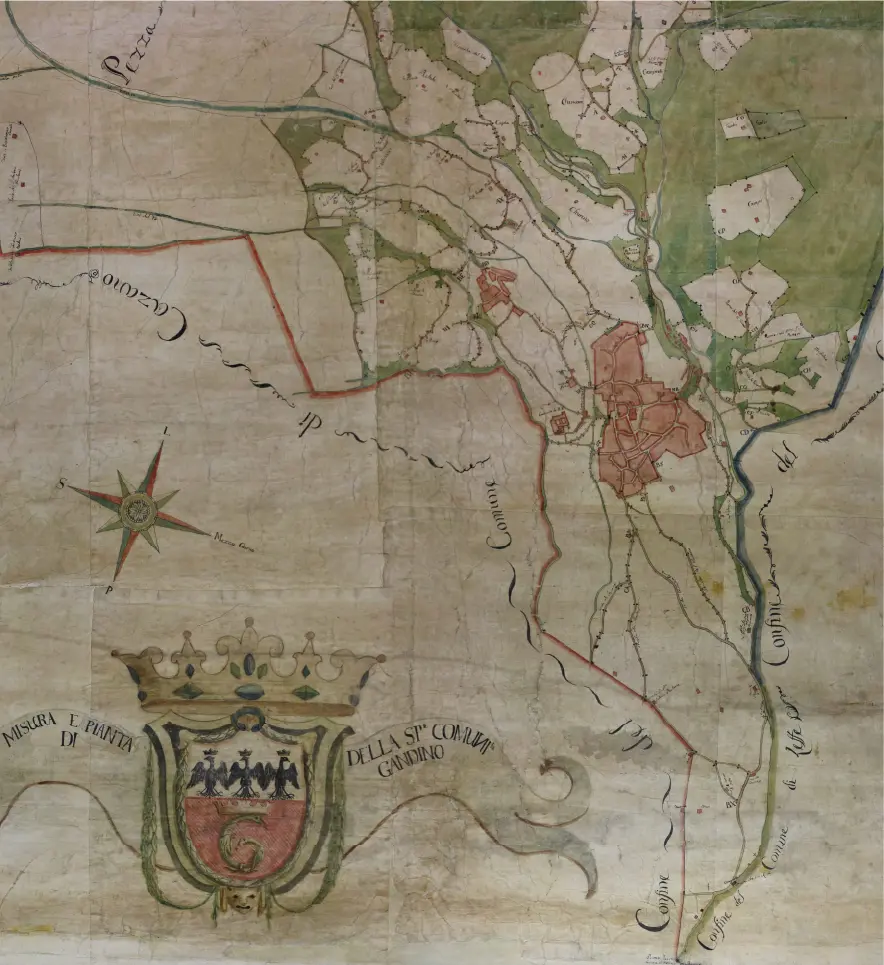
The Gandino Historical Archive preserves an extraordinary document: a large map depicting the municipal territory in the mid-eighteenth century.
The map is accompanied by a register of more than one hundred pages describing it in remarkable detail, including the linear measurements of the municipal boundaries and public properties.
The map and the register are the result of a survey carried out over almost three years (1747–1750). During this period, a land surveyor and four representatives of the municipal administration walked across fields, mountains, and valleys, following slopes and paths to identify the markers placed by local communities, beginning in 1435, as physical boundaries between neighbouring municipalities and between public and private land.
As part of the PRIN2022PNRR project Built in Stone / Preserved on Paper. The Architectural Heritage of Italian Municipalities (12th–20th Century). Historical Research and Digitalization, both the map and the register have been digitized through a high-precision photogrammetric and topographic survey. This work has generated new analytical approaches and raised a number of interpretative questions, while also giving rise to an innovative form of field-based historical research.
A participatory research project
Working together with the municipal administration and the local community, the project aims to locate the historic boundary stones that were originally used for surveying the territory. Many of these markers still survive and can now be identified thanks to the new interpretation of the Calcato developed by researchers at the Department.
During the seminar, a group of local residents, previously contacted by the municipal administration, will volunteer to revisit ancient paths that they already know well, but from a new perspective. Participants will receive instructions and practical tools to systematically collect the coordinates of the surviving boundary stones and contribute to the creation of a shared database.
The data collected will support the georeferencing of the historic map, providing an essential basis for further analysis and comparison with the present-day configuration of the territory.
The initiative represents an important opportunity for collaboration between academic research, local government, and the community, fostering a deeper understanding of the territory while strengthening local identity and social cohesion.