L@rs

Works
The following is a selection of major projects developed in recent years, where advanced research converges with practical application, generating outcomes that support civil society, public institutions, and the business sector.
Services
Below are the services offered by the L@rs Unit to students, teachers, researchers and businesses.
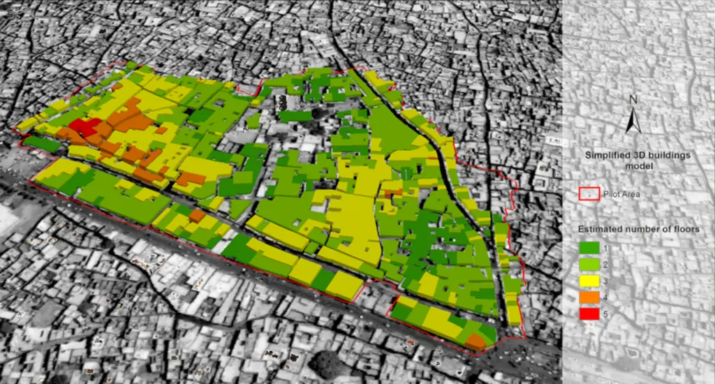
Geographic Information Systems (Geodatabases/GIS/WEBGIS)
Geographic Information Systems (Geodatabases/GIS/WEBGIS) and land information systems for the management, online or otherwise, of georeferenced data, Google Earth and the development of service applications. Creation of geodatabases of map, land and satellite data. Creation and management of Open Source Geoportals and the development of applications based on geospatial services with the use of Virtual Hub Discovery and Access in order to access BIG Data, data from satellites and various maps published in the form of OpenData, INSPIRE and COPERNICUS compliant and EU platforms. Production of thematic and metric maps from satellite or aerial images. Numerical maps, thematic map, risk maps, georeferencing of historical and current maps, navigation techniques and correlation of panoramic historical maps.
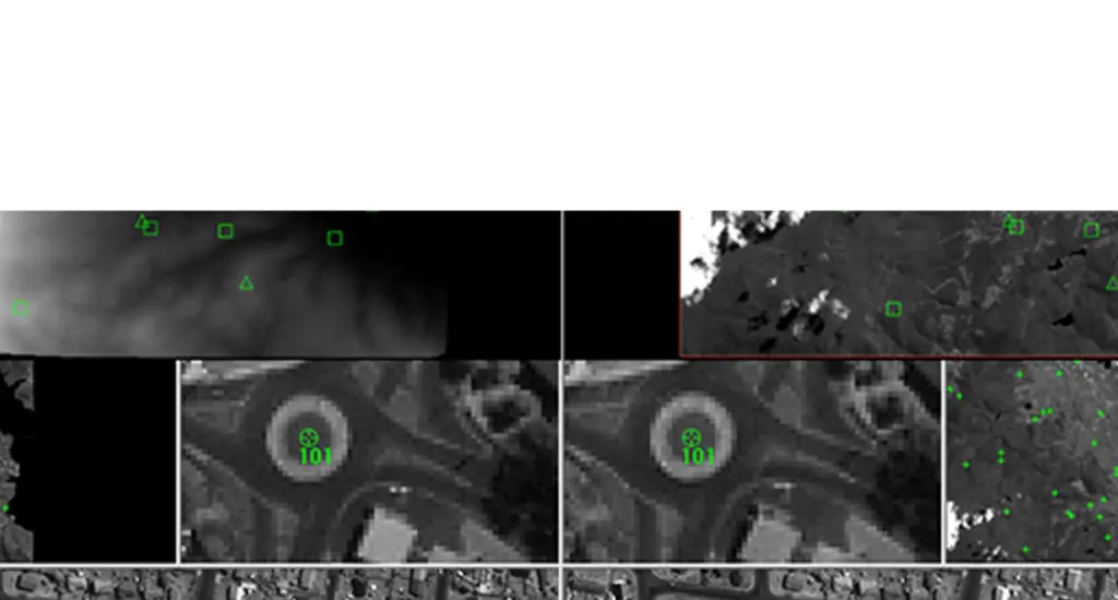
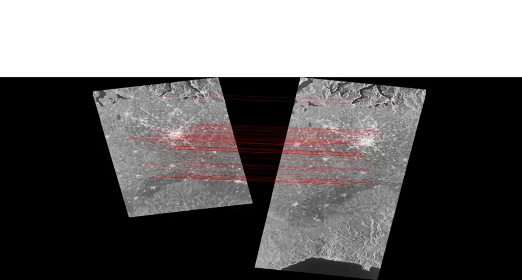
Interferometry/radar intensity
Capture of radar images, pre- and post- processing, interferometry and calculations.
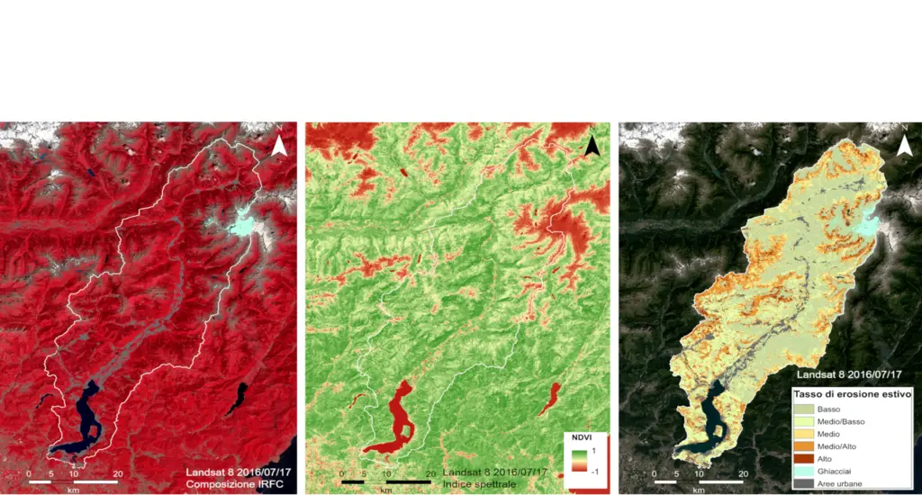
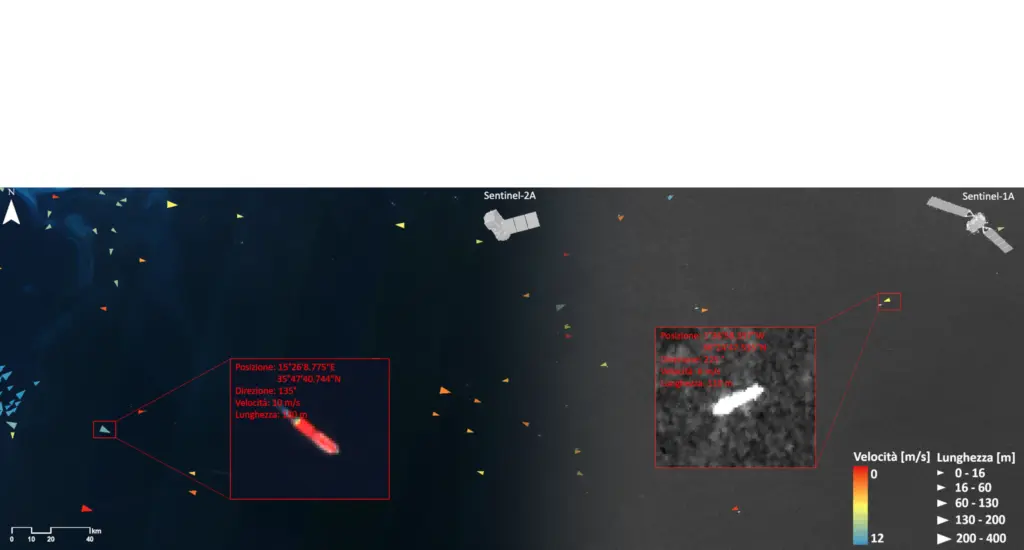
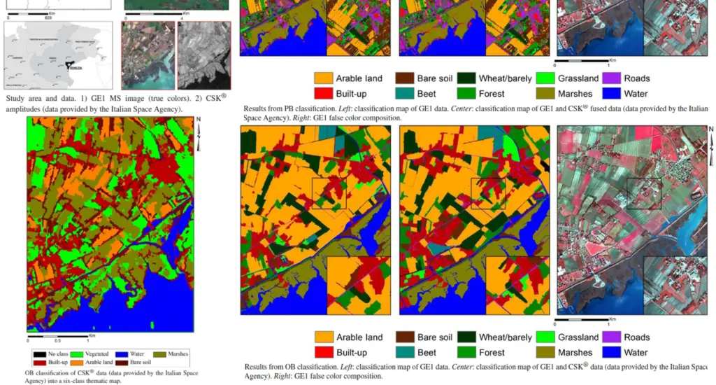
Remote sensing (analysis of satellite and aerial images)
Analysis of multispectral, hyperspectral, thermal and radar (RGB, NIR Near Infrared, IR Infrared, TIR) satellite or aerial images. Remote study of land changes. Assimilation of remote and multi-source data. Modelling of bio- and geo-physical parameters collected remotely.
Tools
NIR StellarNet EPP2000-NIR2b-100 (785-1200 nm)
UV-VIS StellarNet EPP2000C-50 (300-850 nm)
Sfera integratrice
Termocamera per rilievi speditivi FLIR i7